Publié le 3 février 2026
Comment le drone limite le risque d’incendie de forêt causé par les infrastructures électriques
Tel. 09 72 62 78 50 - 09 72 62 78 50info@flyingeye.fr
Publié le 3 février 2026
Vegetation management near high-voltage power lines is a major challenge for network operators. Poorly controlled vegetation can lead to power outages, degrade service quality, and, in certain climatic conditions, trigger wildfires with significant environmental and economic consequences. These risks are particularly high in wooded, rural, or mountainous areas, where access to the terrain is difficult and field operations can be complex.
Given these constraints, traditional inspection methods are now showing their limitations. On-foot inspections are time-consuming, costly, and directly expose teams to operational risks. Helicopter-based surveys, while effective over long linear infrastructures, generate high costs, significant noise pollution, and a substantial carbon footprint. In this context, the use of drones is gradually emerging as a more precise, safer, and more sustainable solution, and companies such as Instadrone and Alteia have partnered to address a need expressed by ENEDIS.
Using drones in the early stages helps secure the entire vegetation management process. Even before field teams arrive on site, network operators gain a clear and comprehensive overview of vegetation conditions around power lines. This approach significantly reduces emergency situations and last-minute decision-making, which are often sources of additional risk.
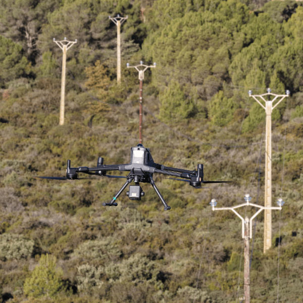
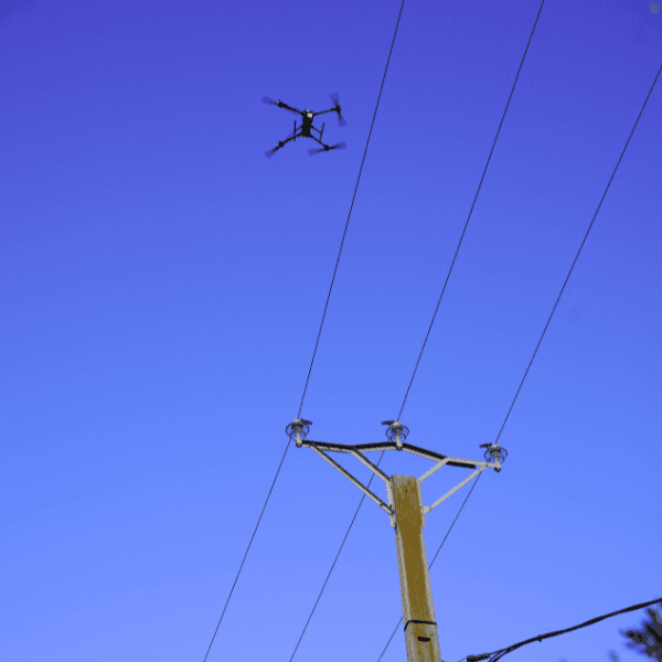
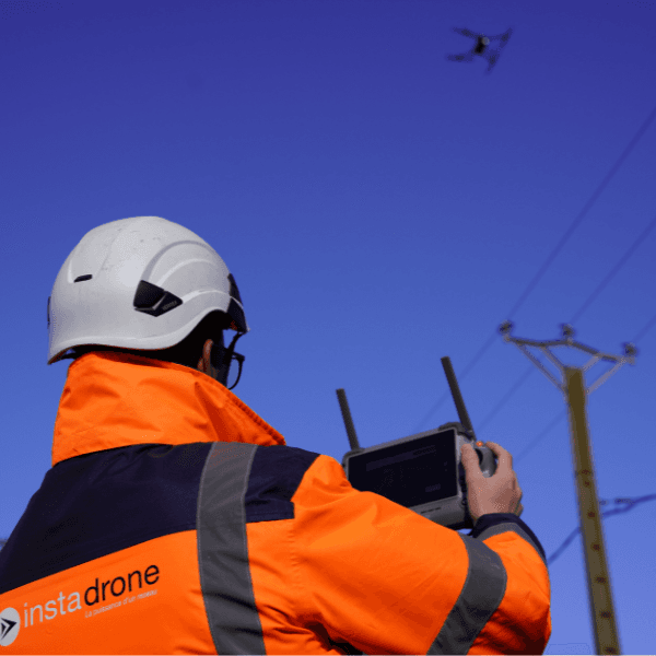
With drones provided by Flying Eye, inspection operations can be carried out without exposing operators to the dangers associated with proximity to live power lines or difficult terrain. Automated flights ensure consistent coverage of the inspected linear infrastructure while maintaining a high level of safety for personnel.
One of the key benefits of drone technology lies in the precision of the data collected. Equipped with next-generation LiDAR sensors, the drones deployed in this case study make it possible to generate detailed 3D models of the environment surrounding power lines. Every tree, branch, and conductor is measured with centimetre-level accuracy.
This data-driven approach transforms decision-making. While visual inspections rely on experience and human interpretation, drones provide objective, measurable, and repeatable information. Safety distances are clearly identified, enabling vegetation management operations to be targeted with a level of precision that was previously difficult to achieve.
ENEDIS, the operator of the largest electricity distribution network in Europe, has been transforming its inspection and maintenance methods for several years. Historically, vegetation management teams intervened based on sometimes approximate field identifications, later supplemented by helicopter surveys equipped with LiDAR sensors.
As part of a broader decarbonisation and industrial modernisation strategy, ENEDIS has progressively shifted its model toward the use of drones. For this case study, the company relies on solutions provided by Flying Eye, a specialist in professional drone technologies, and on the operational expertise of Instadrone for on-the-ground implementation.
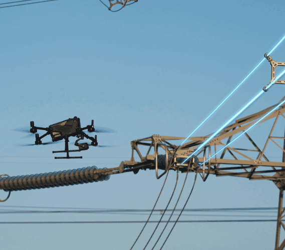
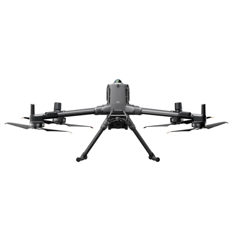
In this project, Flying Eye acts as the drone solution provider by supplying a high-performance aerial platform, the DJI Matrice 400 RTK, paired with the Zenmuse L2 LiDAR sensor. This technological choice enables measurement quality comparable to that of helicopter-based surveys, while significantly reducing costs, noise pollution, and carbon footprint.
The solution provided by Flying Eye meets the specific requirements of high-voltage power line inspections: reliable conductor detection, flight stability, automated line tracking, and the ability to operate at a safe altitude. It therefore represents a key link in the project’s value chain.
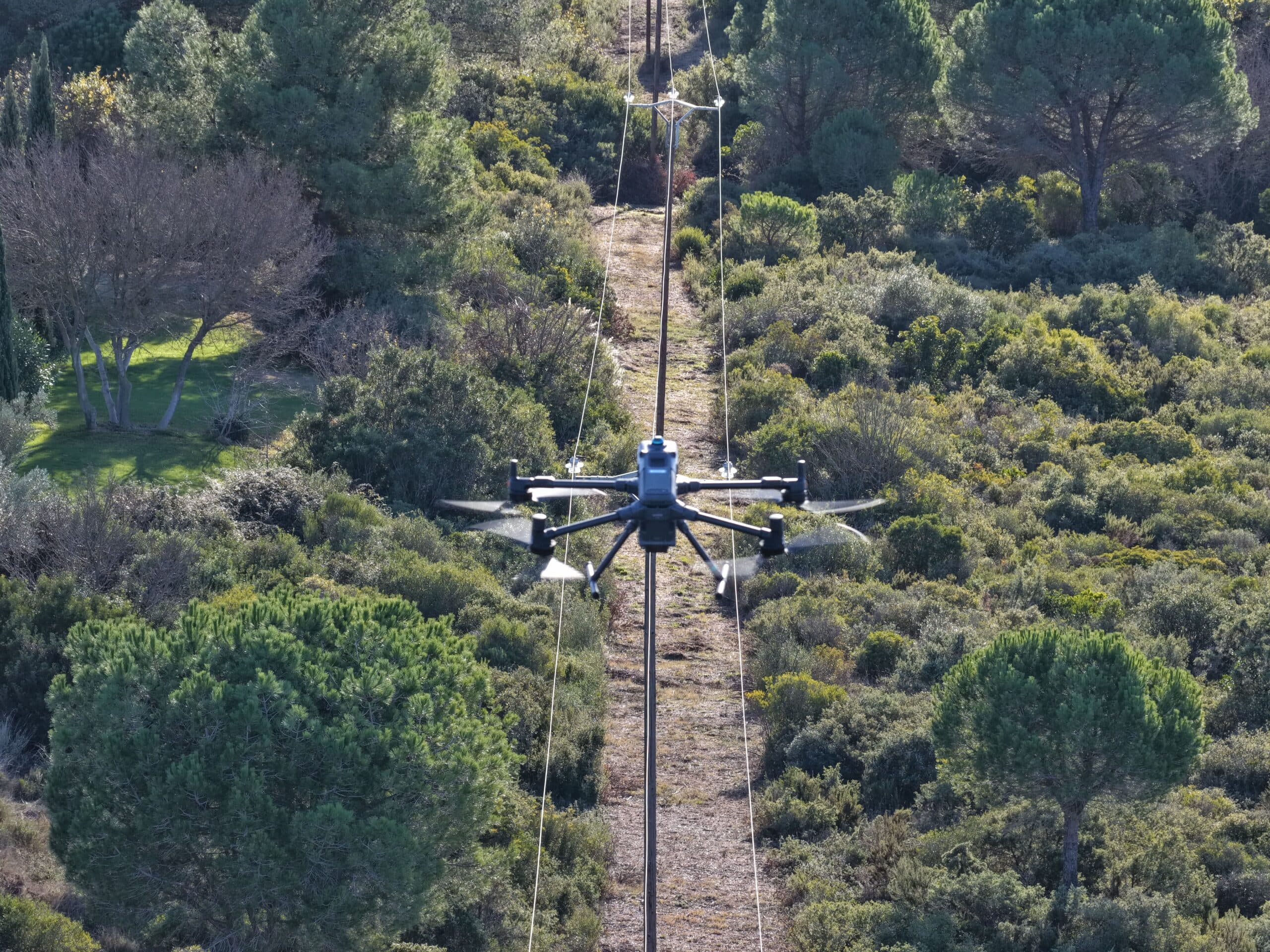
Drone usage is part of a structured process designed to support the entire vegetation management cycle. The first step consists of precisely defining the sections to be inspected, taking into account regulatory and local constraints. Flights are then carried out according to an optimized mission plan, with automated tracking of power lines.
The collected data is processed and analyzed to identify areas where vegetation encroaches on safety distances. This information is delivered in the form of maps and actionable reports for vegetation management teams. Once pruning work has been completed, a new flight is conducted to verify compliance and document the final condition of the lines. This closed-loop workflow improves both the quality of the work and the traceability of operations.
In regions exposed to recurring droughts, wildfire prevention is a top priority. Power lines can become a risk factor when vegetation is not properly controlled. Drones provide a highly effective response by enabling targeted and proportionate vegetation management.
By relying on precise data, network operators can limit interventions strictly to the areas that require them. This approach reduces environmental impact, avoids excessive pruning, and significantly helps lower the risk of fire ignition caused by contact or electrical arcing.
Each method remains useful depending on the context. On-foot inspections are still relevant for highly localized checks, but they quickly reach their limits over long distances. Helicopters remain effective for covering very large linear infrastructures, but their cost and environmental impact limit widespread use.
Drones, as deployed in this case study with solutions provided by Flying Eye, appear to be the best compromise for targeted and sensitive sections. They combine measurement precision, increased safety for teams, and a significant reduction in carbon footprint.
The DJI Matrice 400 RTK, provided by Flying Eye as part of this project, was designed to meet the requirements of complex inspection missions. Its ability to automatically follow power lines, carry a high-performance LiDAR sensor, and perform rapid data acquisition makes it a particularly well-suited tool for pre-vegetation management inspections under high-voltage lines.
This platform enables the collection of actionable data in a minimal number of passes, while maintaining a high level of operational safety.
Integrating drones upstream of vegetation management operations near high-voltage power lines marks a major shift in network management practices. The ENEDIS feedback, based on drone solutions provided by Flying Eye and implemented by Instadrone, demonstrates that it is possible to combine operational performance, human safety, and environmental responsibility.
By delivering a precise, anticipatory, and data-driven view of vegetation-related risks, drones are now becoming an essential tool for grid operators committed to modernizing their infrastructure and supporting the ecological transition.

